The Cascadia Megaquake: Inevitable, Unstoppable, and Closer Than They Admit
The Cascadia Subduction Zone has been silent for 325 years—but the strain is building. With a magnitude 9.0 earthquake inevitable, here's what the experts aren't telling you about the timeline, the tsunami threat, and why the Pacific Northwest remains dangerously unprepared.
The Pacific Northwest is living on borrowed time. Beneath the surface of one of America's most beautiful regions lies a ticking geological time bomb capable of unleashing a magnitude 9.0 earthquake—followed by a tsunami that would make the 2011 Japan disaster look like a rehearsal. The Cascadia Subduction Zone, a 700-mile fault line stretching from Northern California to Vancouver Island, has remained ominously silent for over 325 years. But the strain is building. The plates are locked. And the science is undeniable: the Big One is not a question of if, but when.
For decades, the US government, FEMA, and mainstream scientists have downplayed the Cascadia threat with carefully calibrated probability models—7% here, 15% there—numbers designed to avoid panic while quietly acknowledging catastrophe. But dig deeper into the paleoseismic evidence, the deep-sea landslide scars, and the Japanese tsunami records from 1700, and a far more disturbing picture emerges. The Cascadia fault doesn't operate on our timeline. It operates on geological time. And by those measures, we're overdue.

The Smoking Gun: What Happened in 1700
On January 26, 1700, the Cascadia Subduction Zone let loose with a magnitude 9.0 earthquake that reshaped the Pacific Northwest coastline. The evidence didn't come from European settlers—there weren't any keeping records at the time. It came from three independent sources that corroborate the same catastrophic event.
First, Native American oral histories from dozens of coastal tribes describe a violent shaking that lasted for minutes, followed by a wall of water that drowned entire villages. The stories speak of land dropping by as much as 5 feet, forests sinking into the ocean, and survivors fleeing to higher ground. These weren't myths—they were eyewitness accounts passed down through generations.¹
Second, Japanese tsunami records document a massive "orphan tsunami"—a wave that struck Japan's coast without any preceding earthquake felt locally. Using historical documents from fishing villages, scientists traced the tsunami's origin backward across the Pacific, pinpointing January 26, 1700, as the date of the Cascadia rupture. The timing, magnitude, and direction all match perfectly.²
Third, paleoseismic evidence—sediment layers, tree rings, and coastal subsidence deposits—confirms the event. Geologists have drilled core samples showing sudden land level changes, and they've mapped "ghost forests" of cedar trees killed when saltwater flooded their roots after the ground dropped.³
The 1700 earthquake wasn't a minor event. It was a full-margin rupture—meaning the entire 700-mile fault line slipped at once. The energy released was equivalent to roughly 10,000 Hiroshima atomic bombs. And here's what should keep every West Coast resident awake at night: the geological record shows this has happened 19 times in the past 10,000 years.⁴
The Recurrence Cycle: Why We're in the Danger Zone
Geologists analyzing deep-sea landslide scars—massive underwater avalanches triggered by seismic shaking—have reconstructed Cascadia's earthquake history. The pattern is sobering: major megathrust earthquakes occur roughly every 500 years on average.⁵
But "average" is the key word. The intervals between Cascadia quakes have ranged from as short as 200 years to as long as 1,000 years. The 1700 event followed a relatively short 300-year gap. If the fault follows its average pattern, the next Big One is due around the year 2200. If it follows the shorter interval pattern, we're already living inside the window.
Current GPS measurements confirm the Juan de Fuca Plate is subducting beneath North America at a rate of approximately 1.5 centimeters per year. That might sound slow, but over 325 years, that translates to over 5 meters of accumulated strain—more than enough to generate a magnitude 9.0 rupture. The fault is locked. The pressure is building. And the longer it goes without releasing, the more catastrophic the eventual rupture will be.⁶

What the USGS Isn't Telling You
The United States Geological Survey publishes official probability estimates for Cascadia earthquakes, and their numbers seem designed to reassure rather than alarm. The official USGS Fact Sheet 2024/3050 states there's a 7–15% probability of a magnitude 9.0+ earthquake within the next 50 years, with higher risks in Oregon (10–15%) than Washington (7–10%).⁷
But these numbers tell only part of the story. First, the USGS models don't account for the full range of variability in Cascadia's behavior. A 2024 study in Quaternary Research found that Cascadia produces "great earthquakes of variable magnitude"—meaning the next event could range anywhere from 8.5 to 9.5, depending on which segments of the fault rupture and how the rupture propagates.⁸
Second, the probability models rely on statistical assumptions that may not capture Cascadia's true behavior. Some independent geologists using different statistical methods have calculated probabilities as high as 37% within the next 50 years. The truth is, we don't fully understand the physics of subduction zone earthquakes well enough to make precise predictions.⁹
Third, the USGS focuses on the 50-year window because that's the typical mortgage term and building code planning horizon. But Cascadia doesn't care about human financial planning. The fault operates on century-to-millennium timescales. From a geological perspective, the difference between "tomorrow" and "in 200 years" is essentially meaningless.
The Cascadia-San Andreas Connection: A Double Catastrophe?
Recent research has uncovered a disturbing possibility: the Cascadia Subduction Zone and the San Andreas Fault may be more connected than previously thought. A 2025 study suggested that major earthquakes on the northern San Andreas Fault are often preceded by Cascadia ruptures within minutes to hours—potentially indicating a triggering mechanism.¹⁰
The physics makes sense. Both faults meet at the Mendocino Triple Junction off the coast of Northern California. When Cascadia ruptures, the stress transfer could potentially trigger the San Andreas, or vice versa. If both faults were to go within hours of each other—a "double earthquake" scenario—the consequences would be apocalyptic.
However, the USGS remains cautious about this connection, stating that "no statistically significant causal relationship" has been proven between the two faults.¹¹ The research is preliminary, and the historical record doesn't show clear evidence of simultaneous ruptures. But the possibility adds another layer of uncertainty to an already volatile situation.
The Tsunami: The Real Killer
An earthquake, even a magnitude 9.0, is survivable if you're properly prepared. The tsunami that follows is not.
When Cascadia ruptures, the seafloor will lurch upward by as much as 20 feet in some areas, displacing massive volumes of water. Within 10–15 minutes, a wall of water will slam into the Pacific Northwest coast. Initial waves could reach 30–50 feet high, with subsequent waves potentially exceeding 100 feet in certain coastal configurations.¹²
The inundation zone extends inland for miles in some areas. Coastal towns like Seaside, Cannon Beach, and Long Beach in Oregon; Ocean Shores and Westport in Washington; and communities along the Strait of Juan de Fuca would be completely submerged. Even inland cities like Aberdeen, Hoquiam, and parts of Olympia could face serious flooding.
The 1700 tsunami traveled across the Pacific and damaged coastal villages in Japan. A repeat event would have global consequences—potentially affecting Hawaii, Alaska, and coastal regions throughout the Pacific Rim.
The Aftermath: Life Without Infrastructure
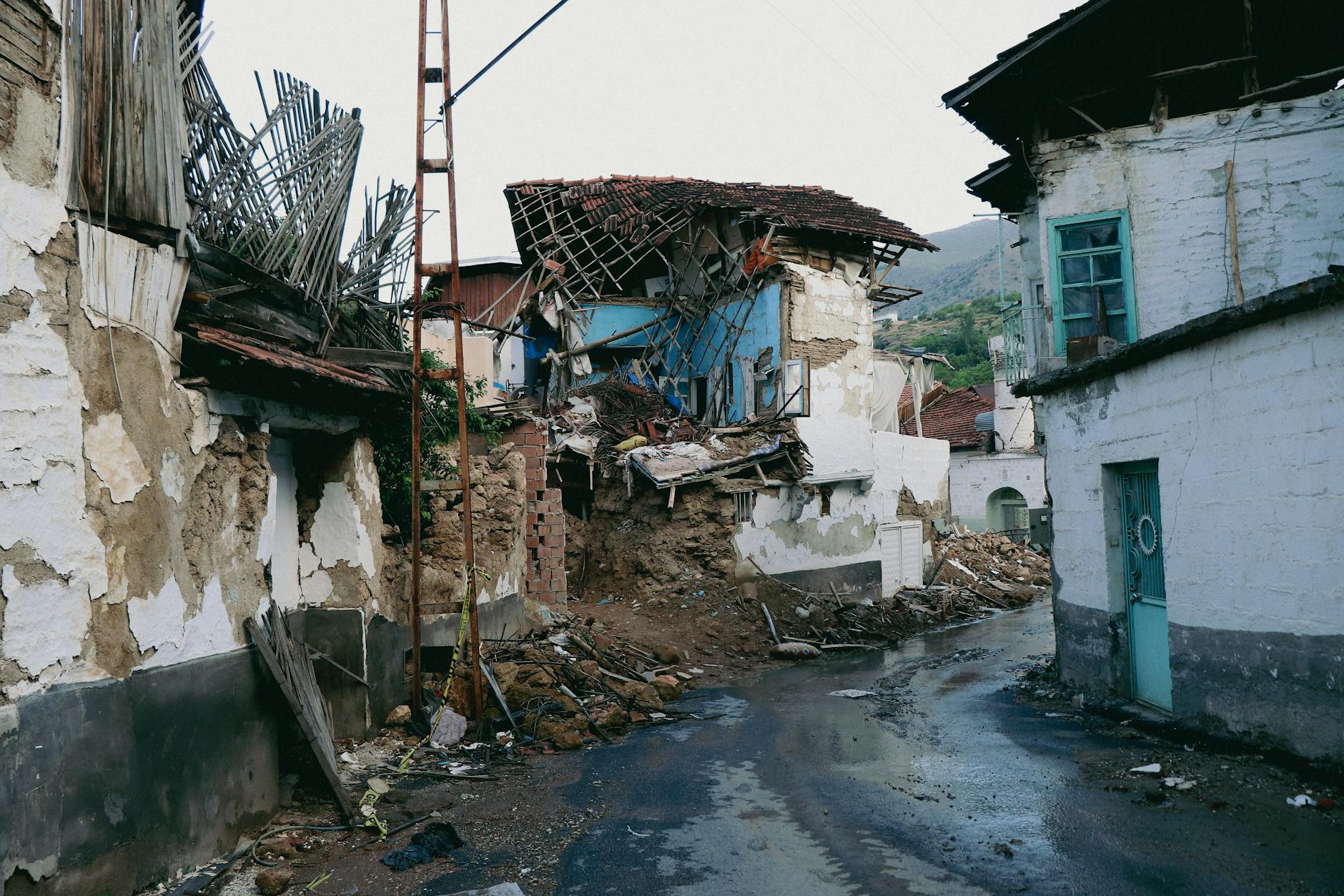
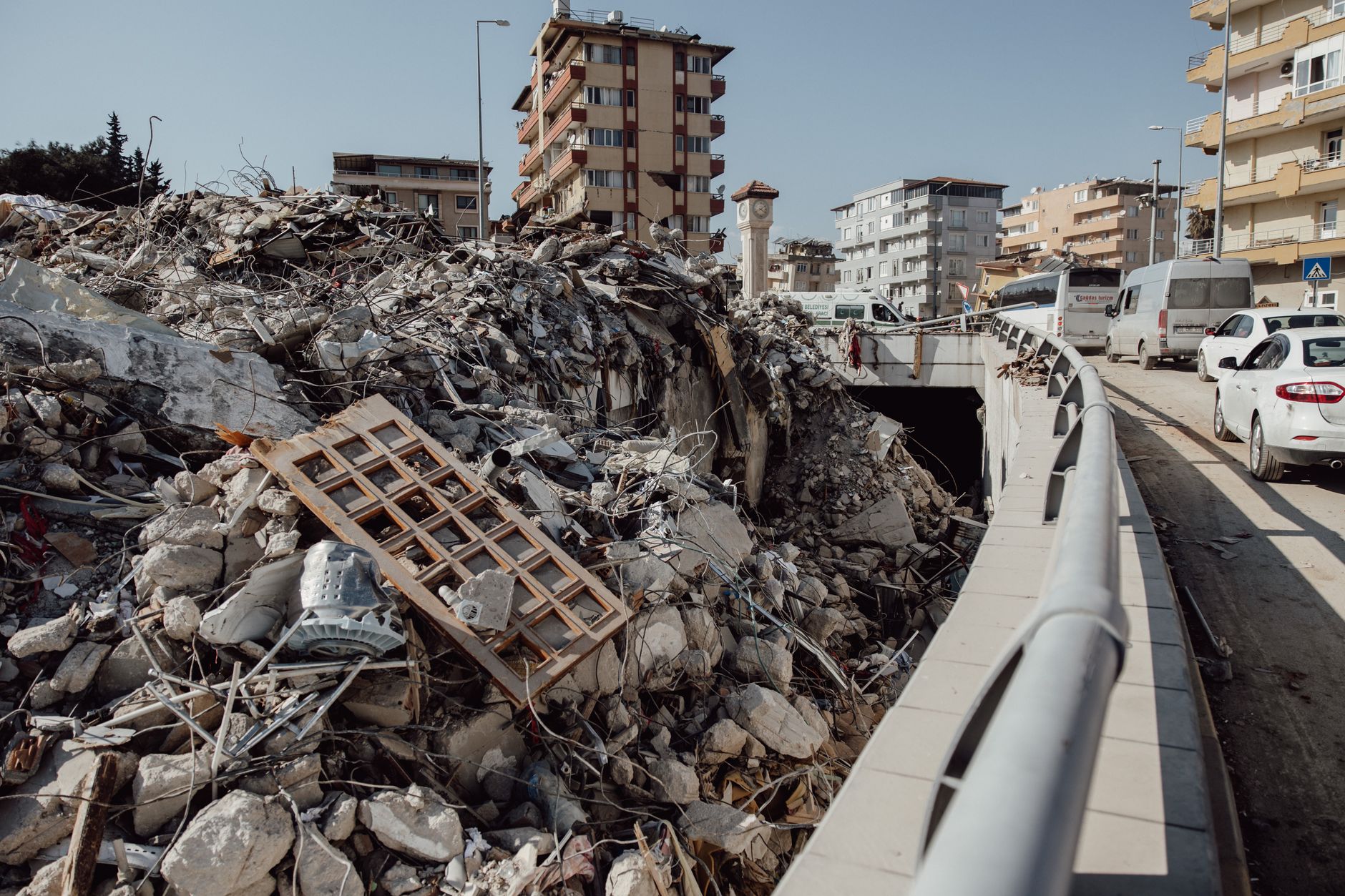
A Cascadia megaquake wouldn't just destroy buildings—it would collapse the entire infrastructure of the Pacific Northwest for months or years.
Power: The electrical grid would fail immediately, with some areas facing outages lasting 6 months to 2 years. Hydroelectric dams along the Columbia River could sustain damage, and transmission lines across the region would be downed by shaking and landslides.¹³
Water: Seattle and Portland's water systems rely on aging pipelines that cross fault lines. Experts estimate 60–80% of the distribution system could be damaged, leaving millions without potable water for months.
Transportation: Interstate 5—the main north-south artery of the West Coast—crosses multiple liquefaction zones and would likely be impassable in numerous locations. The region's bridges, including critical spans across the Columbia River, face catastrophic failure risks. The Port of Portland and Port of Seattle would be crippled.
Communications: Cell towers would topple. Fiber optic cables would sever. The region would be cut off from the rest of the country just when coordination and assistance are most needed.
Medical: Hospitals in the region have made progress in retrofitting, but many would still face structural damage. Emergency services would be overwhelmed. The death toll could reach 20,000 in the first hour, with thousands more dying in the weeks that follow from injuries, disease, and lack of medical care.¹⁴
FEMA has quietly estimated the total economic impact at over $100 billion, making it the most expensive natural disaster in American history. But the human cost—lives lost, communities destroyed, the psychological trauma of an entire region—can't be measured in dollars.
Why Aren't We Ready?
Despite decades of warnings from geologists, the Pacific Northwest remains woefully unprepared. Only 26% of Oregon households have earthquake kits. Less than 10% of residents know their evacuation routes. Building codes have only recently been updated to address Cascadia-level shaking, meaning most structures built before the 1990s face serious collapse risks.
Schools—where our children spend their days—are particularly vulnerable. Many older school buildings in Oregon and Washington would pancake in a major earthquake. Washington passed a law in 2023 mandating seismic upgrades for schools and hospitals, but implementation will take years.
The uncomfortable truth is that preparing for Cascadia requires acknowledging a reality most people would rather ignore. It's expensive. It's inconvenient. It forces us to confront our own mortality and the fragility of the infrastructure we depend on. So we tell ourselves the probability is low. We assume someone else is handling it. We go about our lives.
But the fault doesn't care about our denial.
The Timeline: What Comes Next
We cannot predict the day or hour of the next Cascadia earthquake. But we can understand the timeline of what will happen when it arrives.
0–2 minutes: Initial P-waves arrive. Those closest to the epicenter feel a jolt. The ShakeAlert system, if operational, sends warnings to phones and critical systems.
2–5 minutes: The full S-waves arrive. Ground shaking intensifies to levels that make standing impossible. Buildings begin to collapse. Bridges sway and fail. Underground structures—tunnels, pipelines—crush under the strain.
5–10 minutes: Shaking subsides, but the damage is done. Fires break out from ruptured gas lines. Landslides cascade down hillsides. The coast has minutes to evacuate before the tsunami arrives.
10–30 minutes: The tsunami hits. Those who didn't reach high ground are swept away. Coastal communities disappear under water.
Hours to days: The region is cut off. Power is out. Water systems are down. Emergency services are overwhelmed. Survivors begin the long process of rescue and recovery.
Weeks to months: The full scale of the disaster becomes apparent. Supply chains are broken. Economic activity halts. Mass displacement begins as residents seek shelter and stability elsewhere.
Years to decades: Reconstruction begins, but the Pacific Northwest is forever changed. Some communities may never rebuild. The region's economy and identity are permanently altered.
What You Can Do
If you live in the Pacific Northwest, preparation isn't optional—it's survival. Here's what matters:
1. Have a 72-hour kit. Water (1 gallon per person per day), non-perishable food, medications, first aid supplies, flashlights, batteries, and a battery-powered radio. Store these in multiple locations—home, car, workplace.
2. Know your evacuation route. If you're on the coast, you have 15 minutes max to reach high ground. Practice the route. Know where to go when roads are blocked.
3. Secure your home. Strap water heaters to wall studs. Install seismic shut-off valves on gas lines. Anchor heavy furniture that could topple during shaking.
4. Make a family plan. Where will you meet if separated? Who will you contact outside the region to coordinate? How will you communicate if cell networks are down?
5. Advocate for infrastructure investment. Support building retrofits, early warning systems, and emergency preparedness funding. The cost of preparation is a fraction of the cost of recovery.
Conclusion: Living on Geological Time
The Cascadia Subduction Zone is not a theoretical threat. It is a documented geological feature with a proven history of catastrophic earthquakes. The 1700 event wasn't an anomaly—it was part of a pattern that stretches back 10,000 years.
Whether the next Big One comes tomorrow or in 200 years, it is inevitable. The tectonic plates are moving. The strain is accumulating. The fault is locked and loaded. When it releases, the Pacific Northwest will be forever transformed.
The question for those of us living in this beautiful, dangerous region is not whether we can prevent the Cascadia megaquake. We can't. The question is whether we'll be ready when it arrives. And right now, the answer is: not even close.
They tell us the probability is low. They tell us not to worry. But the rocks beneath our feet tell a different story—and they have 10,000 years of data on their side.
Sources
- Ludwin, R.S., et al. "Dating the 1700 Cascadia Earthquake: Great Coastal Earthquakes in Native Stories." Seismological Research Letters, 2005.
- Satake, K., et al. "Time and Size of a Giant Earthquake in Cascadia Inferred from Japanese Tsunami Records of January 1700." Nature, 1996.
- NOVA/PBS. "The Next Big Earthquake Could Sink Parts of the Pacific Northwest." Documentary, 2024. https://www.youtube.com/watch?v=OQNoO1Ua-q0
- Goldfinger, C., et al. "Turbidite Event History—Methods and Implications for Holocene Paleoseismicity of the Cascadia Subduction Zone." USGS Professional Paper 1661-F, 2012.
- Yahoo News. "Scars from ancient 'megaquakes' at Cascadia subduction zone discovered in deep-sea landslides." https://www.yahoo.com/news/articles/scars-ancient-megaquakes-cascadia-subduction-152920181.html
- USGS Fact Sheet 2024/3050. "Earthquake probabilities and hazards in the U.S. Pacific Northwest." https://pubs.usgs.gov/publication/fs20253050/full
- EurekAlert/AAAS. "Stress-testing the Cascadia Subduction Zone reveals variability that could impact how earthquakes spread." https://www.eurekalert.org/news-releases/1117530
- Cambridge University Press. "Great earthquakes of variable magnitude at the Cascadia subduction zone." Quaternary Research, 2024.
- University of Rhode Island. "Risk Perception of a Major Earthquake Event at the Cascadia Subduction Plate Boundary." Undergraduate Research, 2024.
- Mercury News. "San Andreas, Cascadia faults could combine to set off huge double earthquake, new study finds." October 7, 2025.
- USGS. Cascadia Subduction Zone FAQ and hazard assessments.
- LiveScience. "Scars from ancient 'megaquakes' at Cascadia subduction zone discovered in deep-sea landslides." https://www.livescience.com/planet-earth/earthquakes/scars-from-ancient-megaquakes-at-cascadia-subduction-zone-discovered-in-deep-sea-landslides
- Oregon Department of Geology and Mineral Industries. "Cascadia Earthquake and Tsunami Scenario."
- FEMA Region X. Cascadia Subduction Zone Catastrophic Earthquake Response Plan.